Trip Report: Alternative Spring Break in Guatemala
The Tickle College of Engineering Alternative Spring Break of 2017 took place in Guatemala. Locations visited include Guatemala City, Antigua, Quetzaltenango, San Andres de Xecul, Chichicastenango, Panajachel, San Juan la Laguna and Lake Atitlan.
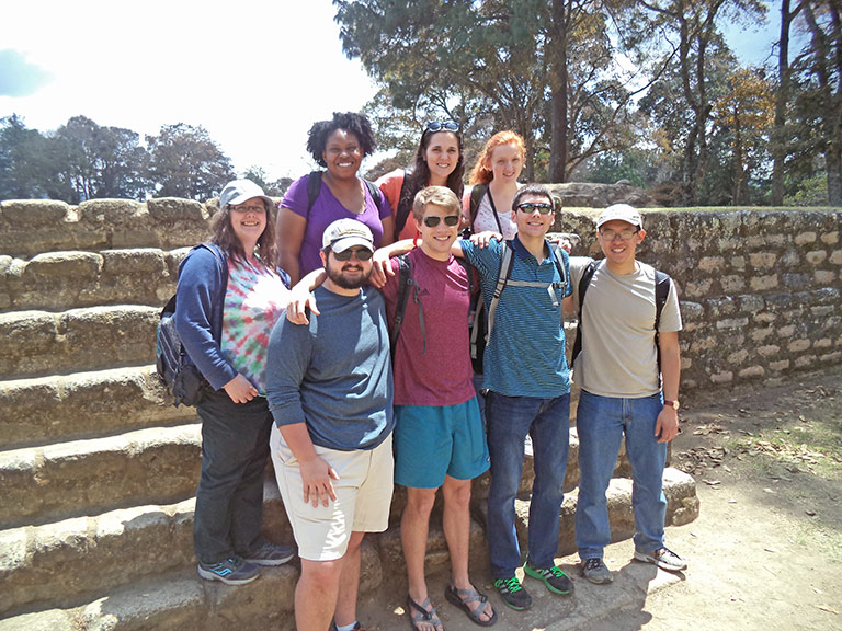
Taking part in the fifteenth trip of Global Initiatives were sophomore Mechanical Engineering majors Mary Daffron and Justin Heath Harmon, Junior Mechanical majors Sarah Higginbotham and Samuel Scruggs, Senior Aerospace major Max Hackenbrack, Junior Civil major Megan Lamon, Junior Electrical major Shavoshia Leslie, and Junior Computer Science major Kevin Ye. Judith Mallory, TCE International Coordinator, arranged and led the trip. Discover Corps of San Diego, an affiliate of the Peace Corps, was the provider.
- Mary Daffron’s Blog »
- Max Hackenbrack’s Blog »
- Heath Harmon’s Blog »
- Sarah Higginbotham’s Blog »
- Megan Lamon’s Blog »
- Shavoshia Leslie’s Blog »
- Samuel Scruggs’ Blog »
- Kevin Ye’s Blog »
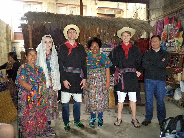
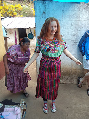
The group flew into Guatemala City’s La Aurora International Airport, where they were met by their in-country guide, Freddy. The first stop on the trip was the colonial town of Antigua. Also known as Old Guatemala City, Antigua (meaning “ancient”) was the third capital of the Kingdom of Guatemala, and is located in the central highlands of Guatemala, famous for its well-preserved Spanish Baroque-influenced architecture. It has been designated a UNESCO World Heritage Site. After dinner and a night in a small hotel in town, the students traveled into the Western Highlands of the country along the Inter-American Highway towards their destination. Along the way, they stopped at a crafts cooperative in the village of San Antonio where a group of indigenous Kaqchikel-speaking women worked on typical Guatemalan handcrafted items; one of them demonstrated the complicated and intricate process of weaving vegetable-dyed fabric by hand. The hosts described a typical Mayan engagement and wedding, complete with several of the students playing the parts of bride, groom, and parents of the groom. One of the women made tortillas on a fire in the floor, which were served with homemade guacamole and “wedding bread” along with strong Guatemalan coffee. Many of their items were available for sale, including shawls, scarves, blouses, tote bags, table runners, pillow covers, hair bands, and more. Freddy explained the importance of supporting this cooperative, as it preserves much of the indigenous heritage of the country and serves as a means of income for the women who are a part of it.
The next stop was the archaeological ruins of Iximche, a Pre-Columbian Mesoamerican archaeological site. Iximche was the capital of the Late Postclassic Kaqchikel Maya kingdom from 1470 until its abandonment in 1524. The architecture of the site included a number of pyramid-temples, palaces and two Mesoamerican ballcourts. Excavators uncovered the poorly preserved remains of painted murals on some of the buildings and ample evidence of human sacrifice. The ruins of Iximche were declared a Guatemalan National Monument in the 1960s. The site has a small museum displaying a number of pieces found there, including sculptures and ceramics. At the time of the Spanish Conquest, Iximche was the second most important city in the Guatemalan Highlands, declared the first capital of the Kingdom of Guatemala in 1524. In 1980, during the Guatemalan Civil War, a meeting took place at the ruins between guerillas and Maya leaders that resulted in the guerillas stating that they would defend indigenous rights. The site’s name derives from the Mayan name of the ramon tree (Brosimum alicastrum), from the words ixim and che, meaning literally “maize tree”.Iximche was called Guatemala by the Spanish, from the Nahuatl Quauhtemallan meaning “forested land”. Since the Spanish conquistadors founded their first capital at Iximche, they took the name of the city used by their Nahuatl-speaking Mexican allies and applied it to the new Spanish city and, by extension, to the kingdom. From this comes the modern name of the country. It sits at 7,410’ in elevation. After visiting the ruins, a typical Guatemalan lunch was served at a restaurant in the countryside along the way to Quetzaltenango, also known by its Maya name, Xelajú, or Xela, and the second largest city of Guatemala. It is located in a mountain valley at an elevation of 7,640’. The city was said to have already been over 300 years old when the Spanish first arrived. Quetzaltenango”, generally is considered to mean “the place of the quetzal bird.”
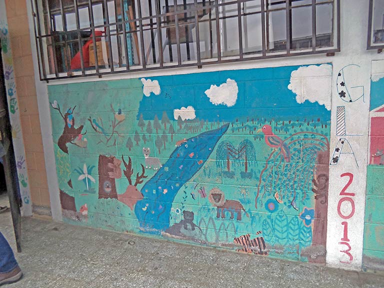
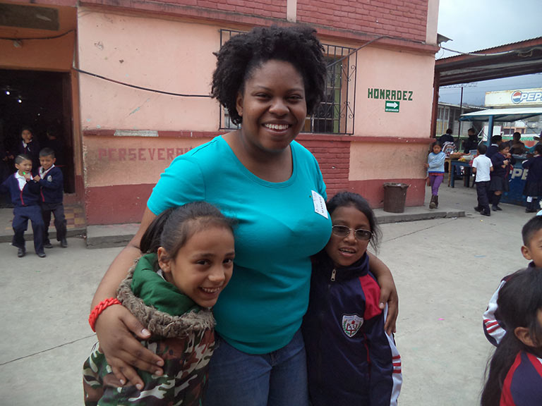
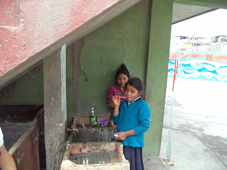
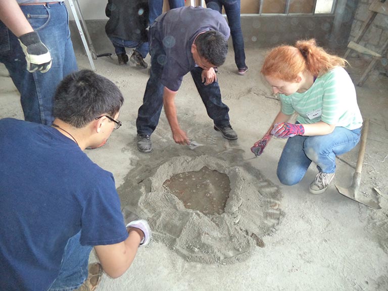
Discover Corps has a “home base” in town for visitors. It is a house and yard separated from the main street by a gate and wall, which is typical in rural and urban parts of Guatemala. The yard was planted with bougainvillea, citrus trees, roses, flowers, vines, and shrubs. Most meals were prepared by native staff on-site. The work project took place at a local school, Escuela Oficial Rural Mixta Pacaja, where several initiatives have already been completed by the Peace Corps, including classrooms and a block of outdoor sinks. The school serves 600 indigenous students, many of whom have breakfast at the school due to the poverty of their families. The school actively promotes indigenous language and culture. Instead of a janitorial staff, the school teaches the children how to sweep, clean, take out trash, and so forth. Immediately after snack time and recess, all children brush their teeth in outdoor sinks. The Engineering students were charged with installing a sheetrock wall supported by metal beams between a roughed-in classroom and what will be a large storage room, located on the second floor of a classroom building. One group worked on the wall for several days, while the other was responsible for creating a rough surface by hand on columns supporting the cinder block construction, in order that a smooth layer of concrete could then be applied, readying the wall for painting. Concrete was mixed on the floor and transported to the wall in small buckets. Nigel, a native of Pacific coastal Guatemala, served as project foreman, in addition to the driver for the students for the week. At the conclusion of the project, students were treated to the same breakfast given to the students, which was a grain porridge and homemade bread. The students of the school put on a small presentation to show their thanks to the visitors from TCE; they dressed in native costumes and danced to indigenous music.
Arturo Gonzalez, a former guerilla who fought against the military during Guatemala’s devastating 36-year civil war, shared his personal experience with the group about living through the genocide of the Maya people. Today, he works to promote human rights in the country. This discussion provided contrast for a subsequent visit by a former Army General, Jose Reuben Castillo, who fought on the side of the military. The upshot is that the war was a horrible event for all concerned with thousands of lives lost, rampant violations of human rights, the infrastructure devastated, and a peace accord at the end.
Cultural activities in Quetzaltenango included a visit to the nearby village of Zunil, to Las Fuentes Georginas hot springs, which are a natural by-product of the volcanic activity of the region; a salsa dance lesson, and a tour of the Old Town, complete with a visit to the City Hall and a roof top coffee shop.
The group took a tour of the village of San Andres de Xecul, a part of a community-based tourism project facilitated by a Peace Corps volunteer who is working to preserve the town’s cultural heritage while also generating income in a sustainable and equitable way for villagers. In the village is perhaps the most colorful cathedrals in the hemisphere, La Iglesia de San Andres de Xecul, a tale of contrasts, on both the interior and exterior. Likely constructed prior to 1500, the church is a lasting legacy of colonialism in Guatemala, and an example of syncretism in Latin American Christianity. The church is obviously Christian; however, images of jaguars (sacred to the Maya) and colors symbolic to the Mayans are used in the decoration. Heaven and Hell are depicted on the façade of the structure. Starkly different from the somewhat drab and cold cathedrals of mainland Europe, La Iglesia de San Andres is a wildly colored and visually-stunning proclamation of faith. Despite the connection of the church with its forceful past, the designs on the facade are distinctly Latin American and more specifically Mayan. Aside from the typical bright colors and designs, many of the figures depicted on the church are also holding ferns, leaves and other plants. This strong connection to nature harkens back to the pre-Columbian era and humans’ interaction with nature. In many ways, the Mayan influenced patterns sharply differentiate the church from classic Christian monuments. However, the bright colors also serve to put the lasting impact of European influence front and center. Modern-day priests recognize both the cross (Christian) and the pyramid (Mayan.) After a hike up a steep hill to a tiny church, the group observed a Mayan ceremony being performed at a gravesite, complete with firecrackers, smoke, burning herbs, and chanting. Further into the woods lived a woman who is preserving an old embroidery technique which she demonstrated on a blouse on which she had been working for six months. The town has a population of 20,000 people, yet a police force of only four individuals; therefore, they have a system in place involving citizens, very much like the “Neighborhood Watch” program of the United States.
Many of the names of the municipalities and towns of Guatemala consist of two parts: the name of the Catholic saint who venerates the day they were founded and a description with Nahuatl root; this is because the troops that invaded the region in the 1520s under Pedro de Alvarado were composed of Spanish soldiers and Tlaxcaltecas and Cholultec Indians. In this case, the name was conferred in honor of the apostle Andrew , while the place name “Xecul” comes from the roots “xe” (Spanish: “low”) and “cul” (Spanish: “blanket”)
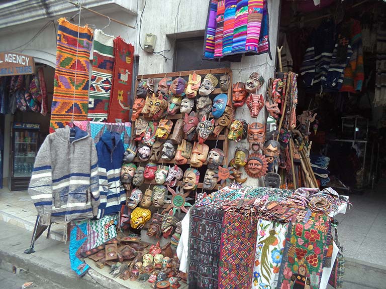
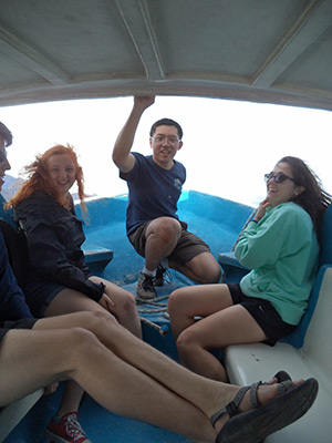
At one point in the drive, the elevation exceeded 10,000’ above sea level. The next stop on the map was a stop at the largest Mayan craft market in the Western Hemisphere, located in the town of Chichicastenango. Machetes, knives, hand woven ítems, statues, handcrafts, religious objects, food, jewelry, and clothing were merely a few of the ítems offered in this market, spreading over several streets and winding into alleyways. From there, the journey continued onto the town of Panajachel and Lake Atitlan, purportedly one of the ten most beautiful lakes on the planet and sacred to the Mayans. The group enjoyed a thirty-five minute ride across the lake in an old boat, and visited the town of San Juan la Laguna on the other side. The lowest point in elevation anywhere around the lake is over 5,500’; at least three volcanoes and several mountains were easily visible from the boat. The main street of the town rose at a 50+ degree grade from the water and contained coffee shops, art galleries, an herb garden and store, and a women’s craft and textile, cooperative, which supports women who might otherwise face poverty and unemployment.
The following morning, the group left for their return flight out of Guatemala City, stopping once again in Antigua for breakfast.